Revit's Project Location and Project Position's functionality is misunderstood most of the time users just starting to learn Revit. In this entry, we will investigate what the effects are of changing the project's Base Point, as well as the project's Survey Point. In addition to the latter, what will happen if we move the project to a new location?
I have added a few walls to a clean project, enabled my Sun Path, and turned my Shadows on. A Spot Coordinate was also placed at my grid intersection.


When accessing the Location Settings, you will be able to specify the location of the project, i.e. affecting the sun's respective location (This is extracted from your lattitude and longitude values)


Survey Point

Project Base Point

Below is the official Autodesk definition of a Project Base Point and a Survey Point:
"The project base point defines the origin (0,0,0) of the project coordinate system. It also can be used to position the building on site and for locating the design elements of a building during construction. Spot coordinates and spot elevations that reference the project coordinate system are displayed relative to this point."
"The survey point represents a known point in the physical world, such as a geodetic survey marker. The survey point is used to correctly orient the building geometry in another coordinate system, such as the coordinate system used in a civil engineering application."
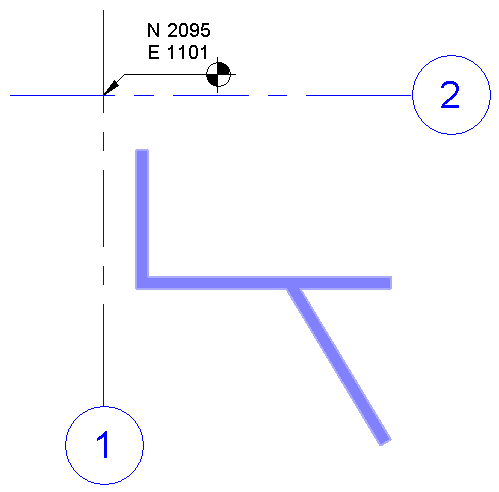
If one now investigate the effects the survey point will have on an engineering drawing, one will see that the survey point plays an integral part in the coordination process. The project file was linked into an MEP template. The engineer will now Acquire the Coordinate System that was specified by the architect.

Notice how the MEP project coordinates updated from N2231, E-2733, to N2095, E1011. This is done to ensure that whenever any project file is linked into another, the specified coordinate system is retained and all files will be in the correct location.
No comments:
Post a Comment